
In the Town of Guilderland there is a hidden gem known as French’s Hollow – home to French’s Hollow Falls and the Vosburgh Trails. The are and its accessible trails are well-maintained and offer a scenic and tranquil hiking experience. The main highlight is Normans Kill (Dutch: “Northman’s Creek”), a historic and picturesque creek that winds through the area. The 45-mile-long stream flows from Duanesburg, NY, through the Capital region, and empties in the Hudson River. Normans Kill in French’s Hollow was dammed in 1915 to form the Watervliet Reservoir – the water source for the nearby city of Watervliet, NY.
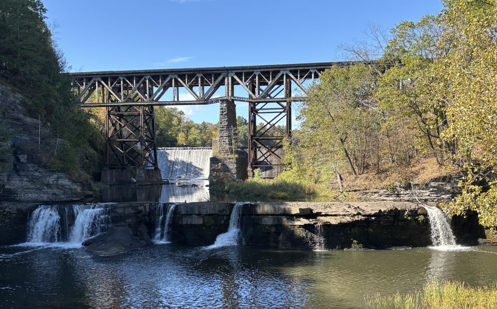
Nearby, you can visit French’s Hollow (or French’s Mill) Falls, a pair of picturesque waterfalls on Norman’s Kill. The upper falls are roughly 8 feet high, and the lower falls are about 6 feet high. In these photos, you can see the historic Penn Central / West Shore trestle, originally built in 1865, framing the falls. The trestle still operates, and you can often see a train overhead.
Historically, the creek powered mills, including French’s Mill, which was an early industrial complex (early 1800’s) consisting of a sawmill, a grist mill, and a textile factory. There are no accessible remains or standing structures from the original mill along the trails, however the history can still be felt and experienced. En route, there is a French’s Hollow historic marker at the intersection of Western Ave and French’s Mill Road. The marker describes and commemorates the site of the original mills established in the late 1700s and early 1800s.
While Normans Kill is spectacular, the rest of the trail system’s natural features should not be overshadowed. The entire ravine was carved out by melting glaciers. The trails often run along an elevated wooded crest, offering beautiful views of the ravine. The trails that wind through meadows and mixed pine hardwood forests offer plenty of opportunities to see wildlife. Taking any of the three color-coded loops – Red, Yellow, or Blue – will allow you to see spectacular biodiversity.


Additional Trail Log Information
| Location Type: | Natural Area |
| Official Site: | Town of Guilderland |
| Address: | 94-50 Frenchs Mill Road Altamont, NY 12009 |
| Location: | 42.7167768 -73.9523379 | View on Map |
| Instagram: | View on Instragram |
| Flickr: | View on Flickr |
| Historical Marker Database: | View Entry |