

AS SEPTEMEBER TIPPED INTO FALL,
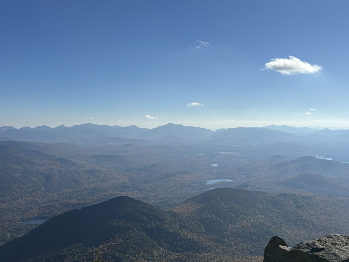
I headed to Whiteface Mountain near Lake Placid, NY. From the top, the Adirondacks stretched out in every direction, a breathtaking 360-degree panorama of just-turning leaves and rugged peaks. It felt like standing inside a living postcard.
Whiteface Mountain is one of the crown jewels of the Adirondacks. Standing tall at 4,867 feet, it’s the fifth-highest peak in New York State, and offers some of the most accessible (and stunning) summit views in the Adirondacks. The mountain has a rugged alpine environment and vistas that stretch as far as Vermont and Canada on a clear day. On my recent trip, the slopes were just coming alive with fall foliage.
As many do, I chose to travel to the summit using the Veteran’s Memorial Highway an engineering and scenic marvel that winds its way up Whiteface, offering one of the most unique summit experiences in the Adirondacks. Open seasonally, the five-mile toll road begins in Wilmington, and climbs steadily through a changing forest. As you travel up, each turn reveals new sights — rolling hills, lakes, and the Adirondack High Peaks.

There are pull-offs along the way where you can stop, take photos, and take in the views. The Lake Placid Turn on is one of the most iconic and scenic turns along the drive to the summit. As you round this incredible wide curve, the road opens up to a cinematic, breathtaking view of Lake Placid. The bend offers one of the mountain’s most dramatic vantage points, and is a reminder of why this drive is considered one of the most beautiful in the Northeast United States. Also, you will find several interpretive signs that point out visible peaks, and discuss the area’s geological history.

Just below the summit, the highway comes to its dramatic finish at Whiteface Castle—a rugged stone structure built during the highway’s original construction in the 1930s. With its fortress-like charm and panoramic perch, it offers a retreat from the mountain winds. Inside, you’ll find restrooms, a gift shop, and a small café where you can warm up with a snack or drink before making the final ascent.


Images of Whiteface Castle at the end of the Veteran’s Memorial Highway. (Click images to enlarge.)
From Whiteface Castle, you can make the trip to the summit using one of two options – both pretty impressive. There is an incredible mountain-hugging trail or an elevator within a tunnel bored deep in the mountain. I took the train, which is a rugged, quarter-mile climb winding along exposed rock, with handrails in kep places place to help steady your path. The trail is narrow, worn and windswept – but offers dramatic views and breathtaking vistas even before you reach the summit. As you climb, you will notice tha the landscape shifts to shrubs and lichen-covered stone – true alpine territory.


Photos taken along the trail to the summit on Whiteface Mountain. (Click images to enlarge.)
At the end of the trail, you will come to the Summit House – a historic stone building at the very top of the peak. The Summit House serves as a scenic lookout and a hub for visitors. Inside, you’ll find the elevator entrance, interpretive signs, and panoramic window views. The Summit House is also adjacent to SUNY Albany’s Atmospheric Sciences Research Center (ASRC) Observatory silo. The weather station here operates year round – even after the highway closes – when students and scientists use snowmobiles and skiis to reach the site. It is the highest weather observatory in the state.


The Summit House and ASRC Weather Station silo at the peak of Whiteface Mountain. (Click images to enlarge.)
At 4,867 feet, the summit delivers a jaw-dropping 360-degree panorama that stretches across the Adirondacks, with views of Lake Placid, Vermont’s Green Mountains, and Canada on a clear day. The visibility was roughly 30 miles at the time I visited the mountain, making it an ideal viewing day.


The trip warranted taking dozens of photos. The above description and photos are only a small sample of the photos I took. Check out the complete Flickr photo gallery.
Additional Trail Log Information
| Location Type: | Natural Area |
| Official Site: | Whiteface Veterans' Memorial Highway |
| Address: | 646 Route 431, Wilmington, NY 12997 |
| Location: | 44.36579 -73.90304 | View on Map |
| Flickr: | View on Flickr |
| Bluesky: | View on Bluesky |
| Historical Marker Database: | View Entry |